Understanding water resources in Latin America and the Caribbean region using environmental tracers
With approximately 660 million inhabitants, Latin America and the Caribbean region finds itself vulnerable to decreasing water availability in a changing climate. Increasing temperatures and abrupt land use changes, if not addressed, will continue the decline in surface water quality and quantity, thereby forcing greater dependence on groundwater extraction. Advancing studies into the availability, replenishment rates and quality of (ground) water are required if the problem is to be tackled. Dr Soto, formerly at the UK Centre for Ecology and Hydrology in Lancaster (UK), and Dr Sánchez-Murillo from Universidad Nacional, Costa Rica’s Stable Isotopes Research Group, have been taking up the challenge.
Stable isotopes are non-radioactive forms of atoms. Acting as a tracer, these isotopes can be used to better characterise and model a variety of chemical and biochemical systems. For instance, water stable isotopes are a reliable, fast and relatively low-cost technique to trace the interactions between rainfall inputs and surface/groundwater connectivity in complex landscapes. They are providing unique insights into the complexity between terrestrial ecosystems and the water cycle, especially in a changing climate.
Acquiring precise information on water patterns using environmental tracers has been exploited for decades in developed countries, but Latin America and the Caribbean (LAC) region has suffered from limited applications of this method. Current research and editorial efforts, spearheaded by Dr David X. Soto, formerly from the UK Centre for Ecology and Hydrology in Lancaster and Dr Ricardo Sánchez-Murillo of the Stable Isotopes Research Group within the Chemistry Department at Universidad Nacional Heredia, Costa Rica, have been addressing this issue. In collaboration with a host of organisations, the team is making serious advances into the hydrological study of the region. For example, the results of this initiative will facilitate sustainability planning in the Central American Isthmus, ultimately improving its water security and sustainability.

Isotopes and the water cycle
The scientific study of the movement and distribution of water on our planet is called Hydrology and includes what is known as ‘the water cycle’. The water cycle outlines how water continuously moves on, above and below the surface of the Earth and in the atmosphere. Elements of this cycle (also known as the hydrological cycle) include precipitation/rainfall, rivers, lakes, water quality, groundwater and flow characteristics. If the connections between rainfall, surface and groundwater are monitored accurately, then the origin and quantity of water in lakes and river basins can be established. This also applies to aquifers; these are bodies of rock and sediment that hold groundwater. Monitoring in this way also makes us develop an appreciation for how water is consumed by vegetation and crops.
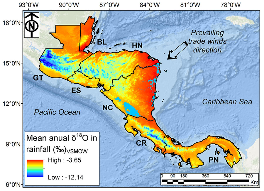
The team was able to develop a regionalised rainfall isoscape for the Central America Isthmus.
Naturally occurring isotopes are separated from those deliberately added. Deuterium (hydrogen-2, with one proton and one neutron in the nucleus), for example, is an isotope twice as heavy as ordinary hydrogen (which only has one proton). Its use is based on acquiring information about a system by measuring the ratio of both isotopes relative to an international standard. Hydrology tracers such as hydrogen isotopes were previously underutilised, or at least under cover, within the LAC region. Having selected studies from several countries – Argentina, Brazil, Chile, Costa Rica, Cuba, Martinique, and Mexico – for their compilation, Dr Soto and Dr Sánchez-Murillo collaborated with teams across these countries to address data-scarcity in this part of the world. Many of these research groups gathered recent and archived stable isotope measurement data sets compiled from rainfall, ground and surface water samples. Many of the latter were extracted from databases from the Isotope Hydrology Section within the International Atomic Energy Agency (IAEA) in Vienna, Austria. The Global Network of Isotopes in Precipitation (GNIP) is a worldwide isotope monitoring network of precipitation initiated in 1960 by IAEA and the World Meteorological Organization (WMO). GNIP analyses the spatial and temporal variations of mainly deuterium and oxygen (oxygen-18) environmental isotopes. In this regard, the researchers importantly also compiled isotopic data from the GNIP database within the Caribbean and Pacific slope of Central America to emphasise the relevance of the Caribbean Sea as a key moisture source into their study.
Investigating and monitoring hydrological connections: The Central America Dry Corridor as an example
In Central America, there’s a strip of land known as the Central America Dry Corridor (CADC) which stretches from Chiapas (Mexico) to the western part of Costa Rica and the western provinces of Panama. It’s a geographical feature called an ‘isthmus’. An isthmus connects two larger landmasses and separates two bodies of water. During a dry season, typically from mid-November to mid-May, the area is characterised by relatively high ambient temperature and minimal rainfall inputs. Groundwater is in great demand in the area because several activities such as agriculture, tourism, mining and hydropower drawing on limited water sources, coupled with climate change have made surface water scarcer. More, long-term droughts are becoming the norm and as water pollution – a result of population growth and unregulated land use – escalates, it is evident that stakeholders (such governments and environmental agencies) need scientists to help them better understand land-water connections. By gathering robust hydrological data, water shortage mitigation strategies can be implemented, and effective sustainable water management practices adopted.
It is essential that Central American countries upgrade their water resources monitoring and management approaches as it is vital to so many of the region’s socio-economic activities. To achieve this, a key driver is improved understanding of the factors which control rainfall patterns in relation to ground and surface water supplies. Groundwater gets replenished by land absorbing water in a process called ‘recharge’ while surface water discharges or flows freely over land contours.
Distribution mapping
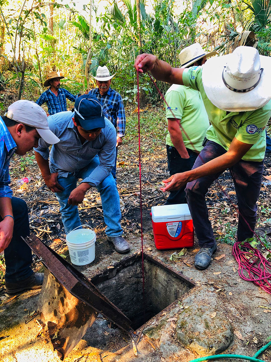
With the recent sampling campaigns across the CADC, the aim was to obtain a better spatial and temporal coverage of stable isotope variations in rainfall, surface water, and groundwater. The rainfall stable isotope data sets are composed of 1,873 samples (2013-2018) with weekly and daily collections. Groundwater was collected from wells and springs while surface water was only sampled from main rivers and streams. Combining archive and recent isotope data, the team was able to develop a regionalised rainfall isoscape for the Central America Isthmus with the valuable help of the Isotope Hydrology Section of the International Atomic Energy Agency and using the GNIP database. An isoscape is, in effect, a map of isotope distributions which, in this case, it allows rainfall-groundwater recharge interactions to be determined.
The data began to paint a picture of the isthmus having marked regular atmospheric circulation patterns.
Armed with this knowledge and isotopic lapse rates (isotopic variations with altitude), the team was able to ascertain potential recharge elevations. This is an indicator of elevation ranges whereby relevant groundwater recharge is primarily taken place.
Perhaps most fascinating was the scientists’ use of an algorithm to compute air mass back trajectories, using the NOAA´s HYSPLIT model. Using time-resolution and key parameters such as starting time, location and altitude, the average position of an air mass was determined and modelled 48 hours backwards in time. In total, the team created 476 air mass back trajectories and divided them into dry season (January-April) and wet season (May-December) groupings. In doing so, moisture circulation patterns emerged which allowed them to make comparisons between the governing moisture transport mechanisms across the Central American Isthmus.
Significant gaps
The results were striking. The data began to paint a picture of the isthmus having marked regular atmospheric patterns. Regionalised temporal patterns in the isotopic composition of rainfall revealed a remarkable isotopic fingerprinting towards the northern portion of the CADC with moisture transport mainly governed by the semi-closed basin of the Caribbean Sea. Similarly, the study revealed other isotopic signals in precipitation during the wet season and mid-summer drought, respectively. Ground and surface water isotopes depicted strong orographic separation into the Caribbean and Pacific domains. This separation is dependent on the form and location of mountains and in the case here, mainly induced by the governing moisture transport from the Caribbean Sea realising complex rainfall patterns across the North-South mountain range. Calculated recharge elevations pointed towards groundwater recharge in highland areas while indicating a clear connection between surface water and groundwater reservoirs. The temporal and spatial gaps noted are significant and have huge implications for groundwater resource sustainability within the CADC.
This work presents the first ever regional synthesis of the spatio-temporal isotopic variability in the CACD region. It highlights the need for an urgent re-assessment of groundwater supply and its usage. Among other intentions, their results should inform water protection regulation decisions and sustainability planning in the Central American Isthmus while impacting on water security facilitation and enhancing forest conservation practices from the knowledge gained from their studies. In doing so, other tropical and subtropical regions should be able to benefit from their blueprint.
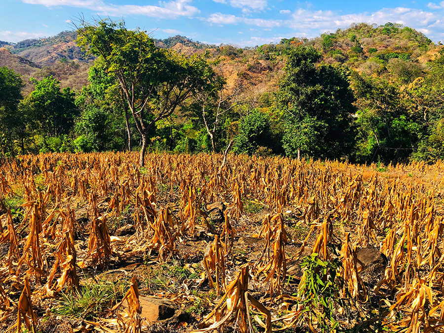
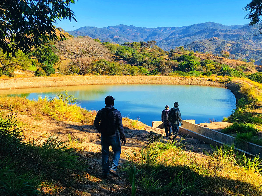
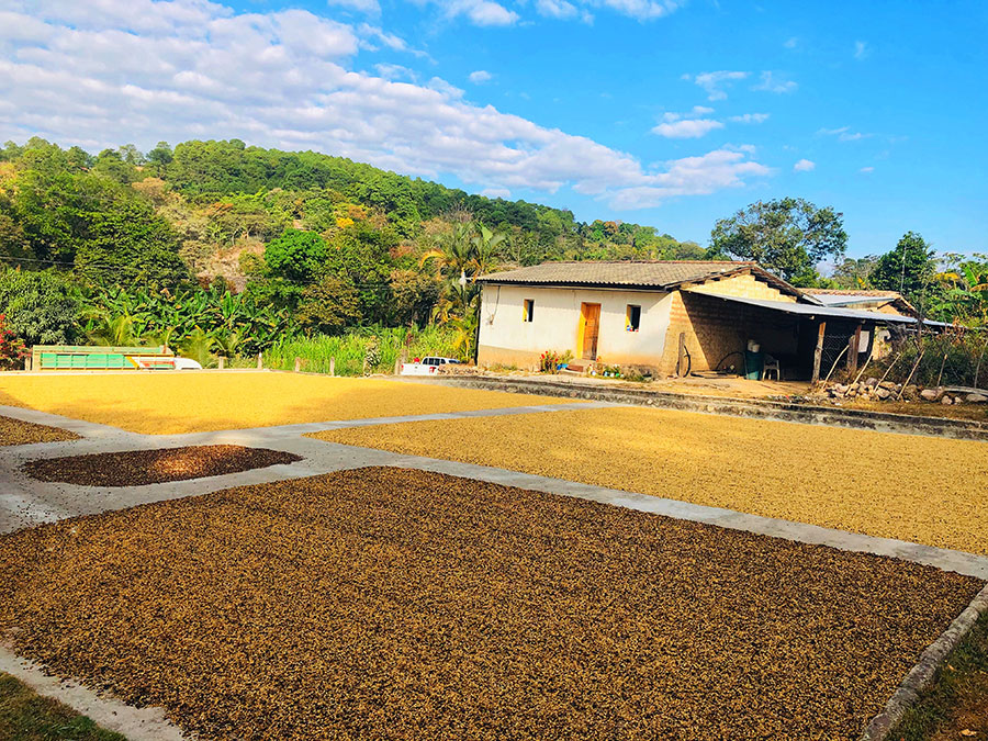
Photo courtesy: R. Sánchez-Murillo
Personal Response
Are there any technological advances you’re considering incorporating into your work that would provide further elucidation?
Tracer hydrological studies are substantially increasing in the Latin America and Caribbean region, although significant challenges remain and several aspects of ecohydrological processes are still poorly understood, such as: a) physically based meaning of 17O-excess variations, b) rainfall generation (i.e., deep and shallow convective development, stratiform fractions) and its correlation with isotope variations in the context of high resolution water vapor data, c) coordination of continuous long-term stable isotope monitoring stations (precipitation, soil, plant, surface, and groundwater), d) standardisation of isoscaping modeling and spatial coverage of sampling efforts, e) appropriate incorporation of stable isotopes measurements into General Circulation Models, paleo-climatic, and ecohydrological models, f) high-frequency measurements during extreme events such as tropical cyclone passages and landfalls, g) tracer-aided and Bayesian mixing models, h) incorporation of tracer hydrology courses in a wide range of related university majors, and i) fostering a more direct connectivity with the ecologists.